Topographic map symbols are far more than mere ink on a page; they are the keys to unlocking the secrets of the wild earth beneath our feet. For thousands of years, humans have felt an intense, instinctual urge to map their surroundings, marking safe paths, deep waters, and towering peaks. By learning to decode these quiet icons, you connect with an ancient lineage of explorers who translated the physical world into a sacred language of survival and discovery. Suddenly, a flat piece of paper transforms into a living, breathing landscape whispering its deepest secrets directly to your soul.
Topographic map symbols are standardized visual icons, colors, and lines used on maps to represent physical terrain, elevation, water bodies, vegetation, and machine-made structures. By translating three-dimensional landscapes onto a flat surface, these symbols allow hikers, explorers, and scientists to safely navigate, measure land heights, and understand the Earth’s diverse features.
Quick Facts About Topographic Map Symbols
| Aspect | Information |
| Origin | Early military cartography and 18th-century European alpine mapping. |
| Historical Significance | Enabled safe mountain exploration, military tactical planning, and accurate resource mining. |
| Main Meaning | A standardized visual vocabulary representing natural terrain and human infrastructure. |
| Spiritual Meaning | The metaphorical blueprint of human consciousness, navigating the high peaks and deep valleys of life. |
| Cultural Importance | Reflects how different societies prioritize land ownership, water resources, and sacred boundaries. |
| Modern Usage | Used daily in wilderness survival, GPS mapping apps, search and rescue operations, and landscape design. |
What Are Topographic Map Symbols?
At its heart, a topographic map is a two-dimensional portrait of a three-dimensional world. Because we cannot fit actual mountains and rivers onto a portable sheet of paper or a phone screen, cartographers created a brilliant shorthand system. These symbols are the graphic alphabet of the wild.
The origin of these symbols dates back to the late 18th century. Before this era, maps were artistic but highly inaccurate paintings of hills and castles. As nations began to build railways, wage strategic wars, and mine for coal, they needed absolute precision. Cartographers began using mathematical contour lines to show height, and they assigned specific colors to different features: blue for water, green for forests, and brown for the earth itself.
Over time, agencies like the United States Geological Survey (USGS) standardized these symbols. Today, whether you are looking at a vintage paper map or a modern GPS application, this visual system remains the global standard for finding your way through the unknown.
Deep Symbolic Meaning of Topographic Map Symbols
While these symbols serve a practical purpose, they also carry profound metaphorical weight. Humans are natural pattern-seekers, and we instinctively project our inner worlds onto the outer landscape.
The Spiritual Level: Mapping the Soul’s Journey
On a spiritual level, a topographic map is a mirror of the human experience. The steep, tightly packed contour lines of a mountain represent our greatest challenges and spiritual ascents. Standing at a peak symbolizes enlightenment, clarity, and triumph over adversity. Conversely, the blue lines of rivers and streams mirror the flow of our emotions and the subconscious mind. Navigating a map is a spiritual exercise in trust, showing us that even when the path is steep, there is always a way forward.
The Psychological Level: Navigating the Inner Landscape
Psychologist Carl Jung believed that landscapes in dreams represent the structure of our own minds. In Jungian psychology, a dense forest symbol on a map represents the unconscious mind, a place of mystery and hidden treasures where we must go to find our true selves.
A clear, marked trail represents the conscious ego, the safe and structured path we walk to stay in control. When we look at a map, we are psychologically organizing the chaos of nature, satisfying our primal need for safety, predictability, and order.
The Cultural Level: Defining Sacred Boundaries
Culturally, map symbols show us what a society values. In dry climates, ancient maps marked water sources with sacred geometry, treating them as life-giving shrines. In industrial societies, maps are often dominated by black lines representing roads and railways, reflecting a cultural focus on connection, commerce, and progress. Every map symbol is a cultural footprint, showing how we interact with the spirit of the land.
Types and Variations of Topographic Map Symbols
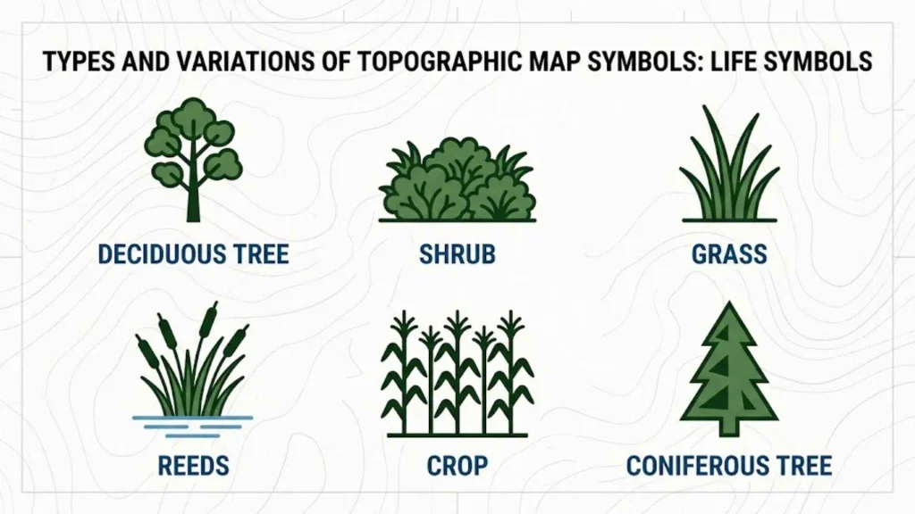
To read a map like a seasoned tracker, you must understand the different categories of symbols. Each category uses specific colors and shapes to tell a distinct story.
[Topographic Map Symbols]
├── Contour Lines (Brown) -> Represents elevation, slopes, and cliffs
├── Hydrographic Symbols (Blue) -> Represents rivers, lakes, swamps, and glaciers
├── Vegetation Symbols (Green) -> Represents forests, orchards, and scrubland
└── Cultural Features (Black/Red) -> Represents trails, buildings, and boundaries
Topographic Map Symbols With Names and Meanings
Topographic maps use standardized symbols to show natural landforms, water features, vegetation, roads, buildings, and other important details. Learning topographic map symbols with names makes it easier to understand the landscape without seeing it in person. Although some symbols vary between countries and map publishers, many follow similar conventions.
Here are 10 common topographic map symbols and what they represent:
| Topographic Map Symbol | Name | What It Represents |
| Contour lines | Elevation lines | Show the shape, height, and steepness of the land |
| Blue wavy lines | Stream or river | Identify flowing water |
| Blue enclosed area | Lake or pond | Shows a body of water |
| Black or colored road line | Road | Marks a road or transport route |
| Green shaded area | Woodland or forest | Indicates tree cover or wooded land |
| Small building outline | Building | Marks a structure or developed site |
| Marsh or wetland markings | Marsh or swamp | Identifies wet or waterlogged ground |
| Spot elevation | Elevation point | Gives the height of a specific location |
| Triangulation or survey point | Survey control point | Marks a point used for measuring and mapping |
| Dashed trail line | Footpath or trail | Shows a walking route or minor path |
The exact appearance and color of these symbols depend on the map’s legend and the mapping agency that produced it. Always check the legend before interpreting unfamiliar markings.
Contour Lines (The Shape of the Earth)
- Visual Description: Fine brown lines that wind across the map, sometimes grouped closely together and sometimes spaced far apart.
- Meaning: These lines connect points of equal elevation. When they are close together, the terrain is incredibly steep. When they are far apart, the land is flat.
- Symbolism: The ups and downs of life’s journey, representing struggle, perspective, and achievement.
- Where It Appears: Every standard topographic map, showing mountains, valleys, depressions, and flat plains.
Hydrographic Symbols (Water Features)
- Visual Description: Blue lines, solid shapes, or dotted patterns.
- Meaning: Solid blue represents permanent water like rivers and lakes. Dotted blue lines represent intermittent streams that only flow during rainy seasons.
- Symbolism: Emotion, intuition, purification, and the unstoppable flow of time.
- Where It Appears: Rivers, oceans, glaciers, swamps, and water wells.
Vegetation Symbols (The Green Canopy)
- Visual Description: Green shaded areas, sometimes accompanied by tiny icons of trees.
- Meaning: Green indicates covered land, such as dense forests, scrub, or orchards. White areas on a topographic map usually mean clear, open land like meadows or deserts.
- Symbolism: Growth, life, shelter, and the wild, untamed aspects of nature.
- Where It Appears: National forests, state parks, and wooded valleys.
Cultural and artificial, Features (The Human Footprint)
- Visual Description: Black or red icons, including dashed lines, solid squares, and cross symbols.
- Meaning: Black represents buildings, schools, churches, and trails. Red represents major highways and land boundaries.
- Symbolism: Human connection, civilization, structure, and our desire to tame the wilderness.
- Where It Appears: Cities, rural outposts, historic ruins, and campsite locations.
Topographic Map Legend: How to Read the Map Key
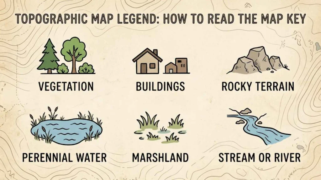
A topographic map legend, also called a map key, explains the symbols, colors, lines, and patterns used on a map. It allows readers to identify features accurately instead of guessing what each marking means. The legend is usually printed in the map margin or included in the map’s accompanying information.
What Does a Topographic Map Legend Include?
A typical topographic map legend may contain the following categories:
- Natural features: Rivers, lakes, forests, wetlands, cliffs, and other landscape features.
- Elevation features: Contour lines, index contours, spot elevations, and benchmarks.
- Transportation features: Roads, trails, railways, and bridges.
- Buildings and structures: Houses, schools, public buildings, and other developed areas.
- Boundaries and reference marks: Property or administrative boundaries, survey points, and grid references.
Topographic Map Symbols vs. Map Key
Topographic map symbols are the visual marks used to represent real-world features. The map key explains what those marks mean. For example, a blue line may represent a stream, while a series of brown contour lines shows changes in elevation.
A physical map legend may also explain colors used to distinguish land, water, and elevation. However, the meaning of a color can differ by map type, country, and publisher. The safest approach is to consult the legend on the specific map you are reading.
How to Use a Topographic Map Key
Start by locating the legend. Find the symbol you want to identify, read its label, and then locate the same marking on the map. Next, compare it with nearby contour lines, roads, and water features to understand its location and relationship to the surrounding terrain. This simple process makes even a detailed topographic map easier to interpret.
USGS Topographic Map Symbols
The United States Geological Survey (USGS) produces topographic maps that represent terrain, elevation, water features, transportation networks, vegetation, and human-made structures. USGS topographic map symbols help readers interpret these features using standardized cartographic conventions.
Military Topographic Map Symbols
Military topographic map symbols help military personnel understand terrain, navigation routes, transportation networks, and other operationally relevant features. These maps may combine ordinary topographic information with additional symbols used to represent military units, equipment, boundaries, and activities.
Common Categories of Military Map Symbols
Military maps can include several types of information:
- Terrain symbols: Represent hills, valleys, ridges, rivers, and other natural features.
- Transportation symbols: Show roads, tracks, bridges, and routes that affect movement.
- Elevation information: Contour lines and spot elevations help readers understand the shape and steepness of the land.
- Unit and equipment symbols: Military-specific markings can identify units, equipment, and organizational information.
- Boundaries and control measures: Certain line styles can indicate designated boundaries or other operational reference lines.
Topographic Map Symbols in South Africa
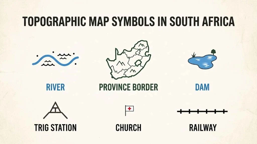
Topographic maps in South Africa represent the country’s varied landscapes, including mountains, valleys, rivers, dams, roads, settlements, agricultural land, and natural vegetation. These maps are useful for outdoor navigation, land management, environmental studies, surveying, and geography education.
Features Shown on South African Topographic Maps
Common features include:
- Mountains and hills: Contour lines show elevation changes and help readers recognize steep slopes and ridges.
- Rivers and dams: Water-related symbols identify streams, rivers, reservoirs, and other mapped water features.
- Roads and tracks: Different line styles can distinguish major roads from minor routes and tracks.
- Settlements and buildings: Symbols identify towns, developed areas, and individual structures where mapped.
- Vegetation and land cover: Colors and patterns may distinguish woodland, cultivated land, and other types of ground cover.
- Elevation reference points: Height labels and survey points provide information about the elevation of specific locations.
Topographic Map Symbols for Students and Geography
Topographic map symbols are an important part of geography because they help students understand how maps represent real landscapes. Instead of showing every object exactly as it looks in real life, a map uses simple symbols, lines, colors, and patterns to communicate information clearly.
Basic Topographic Map Symbols Students Should Learn
Students should begin with a small group of common symbols:
- Contour lines: Show elevation and the shape of the land.
- River or stream: Represents flowing water.
- Lake or dam: Identifies a body of water.
- Road: Shows a transportation route.
- Railway: Indicates a railway line.
- Forest: Represents woodland or tree cover.
- Building: Marks a structure or developed location.
- Footpath: Shows a walking route.
- Spot height: Gives the elevation of a particular point.
- Marsh: Indicates wet or waterlogged ground.
The symbol designs may differ between maps, so students should always use the accompanying map key.
Common Topographic Map Symbols Worksheet Activity
A simple worksheet can help learners practise identifying map symbols and interpreting terrain. Students can complete these activities:
- Match each symbol to its correct name.
- Identify three natural features and three human-made features.
- Find the steepest area by comparing the spacing of contour lines.
- Trace a route between two locations while noting any rivers or steep slopes.
- Use the legend to explain the meaning of five unfamiliar markings.
Topographic Map Symbols Across Different Cultures
The way we symbolize the earth has evolved beautifully across civilizations, reflecting different spiritual and practical relationships with the land.
Ancient Egypt: Mapping the Sacred Nile
The Egyptians did not have modern topographic maps, but they used symbolic papyrus drawings to map the Nile Valley. They represented the river as a flowing snake or a series of blue zig-zag lines. For them, water symbols were deeply tied to the underworld and the afterlife, mapping not just the physical earth, but the journey of the soul into eternity.
Ancient Greece: The Cosmos and Cartography
The Greeks were pioneers of scientific mapping. They used early symbols to divide the earth into climate zones. They viewed map symbols as sacred geometry, believing that the physical coordinates of mountains and cities reflected the perfect, divine order of the cosmos.
Roman Culture: Roads and Imperial Order
Roman maps, such as the famous Peutinger Map, prioritized practical navigation. They used bold, simplified symbols for roads, bathhouses, and military outposts. To the Romans, map symbols were tools of empire and control, proving that to map a territory was to own it.
Eastern Traditions: Feng Shui and Sacred Geography
In ancient China, maps were heavily influenced by Feng Shui. Mountain ranges were symbolized as sleeping dragons, and water bodies were drawn to show the flow of “Qi” (life energy). Map symbols were not just physical markers, but spiritual guides showing where to build homes to live in harmony with the earth.
Indigenous Traditions: Songlines and Living Maps
Many Indigenous cultures, such as the Australian Aboriginal peoples, used “songlines” and oral cartography. They did not paint lines on paper; instead, they used songs, stories, and rock art symbols to map the land. A specific rock symbol might represent a sacred ancestor, a water hole, and a survival guide all at once, proving that the map is a living, breathing entity.
Similar Symbols and Their Meanings
It is easy to confuse topographic map symbols with other navigation and design symbols. Let us compare them to see what makes them unique.
| Feature / Symbol | Topographic Map Symbols | Cadastral Map Symbols | Weather Map Symbols |
| Primary Focus | Physical terrain, elevation, and natural features. | Property boundaries, land ownership, and tax lots. | Atmospheric pressure, wind speeds, and storm fronts. |
| Key Colors Used | Brown, green, blue, black, and red. | Mostly black and white with colored parcel highlights. | Blue (cold fronts), red (warm fronts), and grey (isobars). |
| Common Icon | Contour lines, tree clusters, and water flow arrows. | Lot numbers, survey pegs, and property line dashes. | H (high pressure), L (low pressure), and rain cloud icons. |
| Target Audience | Hikers, geologists, search and rescue, and military. | Real estate agents, city planners, and landowners. | Meteorologists, pilots, and the general public. |
Topographic Map Symbols in Mythology and Folklore
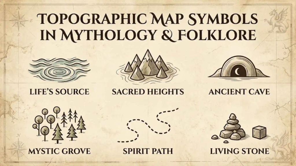
Throughout history, maps have been used to bridge the gap between reality and myth. In medieval times, cartographers drew terrifying sea monsters, dragons, and sirens on the edges of maps. These symbols warned travelers of the dangers of the unknown, representing the psychological boundaries of human knowledge.
In folklore, maps were often magical objects. From the legendary maps of Eldorado to Celtic stories of hidden paths into the fairy realms, symbols were used to hide sacred treasures. The symbols themselves acted as riddles; only those with a pure heart or secret knowledge could read the lines of the earth to find the entrance to the magical world.
Topographic Map Symbols in Art, Literature, and Pop Culture
Today, the aesthetic of the topographic map has captured the modern imagination, appearing across various creative landscapes.
- In Literature: J.R.R. Tolkien famously hand-drew the maps for The Lord of the Rings. His beautiful symbols for the mountains of Mordor and the forests of Lothlórien made the fantasy world feel real and historical.
- In Movies: Adventure films like Indiana Jones use moving red line symbols on ancient maps to build excitement, turning simple cartography into a symbol of thrilling adventure.
- In Tattoos and Fashion: Many outdoor enthusiasts get topographic contour lines tattooed on their skin. These lines often represent a specific mountain they climbed or a place where they found personal peace, serving as a permanent symbol of inner strength.
- In Home Decor: Modern minimalist designers use topographic wooden carvings and wall art to bring the calming, organic patterns of the earth into urban living spaces.
Spiritual and Dream Meaning of Topographic Map Symbols
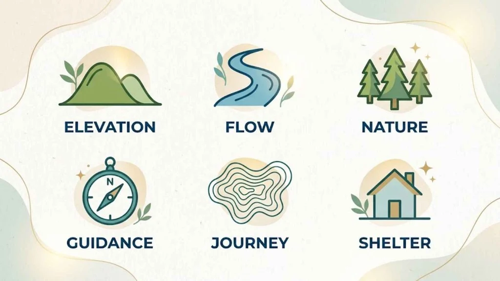
Have you ever dreamed of searching a map or getting lost among strange symbols? These dreams hold powerful messages.
- Dreaming of Contour Lines: If you are climbing steep, brown contour lines in a dream, you are likely facing a major challenge in your waking life. The dream is encouraging you to pace yourself, reminding you that the view from the summit is worth the struggle.
- Dreaming of a Blue Water Symbol: Finding a clear lake or river symbol suggests emotional healing. You are ready to let go of old blockages and let your feelings flow naturally.
- Dreaming of Being Unable to Read a Map: This is a classic sign of feeling lost, overwhelmed, or directionless in your career or relationships. It is a gentle reminder from your subconscious to slow down, find your bearings, and seek guidance.
Positive and Negative Meanings of Topographic Map Symbols
Just like life, the symbols on a map can represent both safety and danger depending on how we read them.
| Positive Meaning (The Light) | Negative Meaning (The Shadow) |
| A Marked Trail: Guidance, safety, structure, and a clear life path. | A Cliff Symbol: Danger, sudden endings, instability, and fear of falling. |
| A Water Source: Life, nourishment, emotional depth, and renewal. | A Swamp Symbol: Feeling stuck, stagnant emotions, and hidden dangers. |
| A Mountain Peak: Achievement, high perspective, and spiritual growth. | A Deep Depression: Sadness, feeling trapped, and emotional low points. |
Why Humans Are Attracted to Topographic Map Symbols
Our love for maps is deeply wired into our biology. As ancient hunter-gatherers, our survival depended on our ability to read the landscape. We had to recognize the shape of a mountain on the horizon or remember the exact bend of a river.
Psychologically, we are comforted by patterns. When we look at the beautiful, winding lines of a topographic map, our brains experience a sense of calm. These symbols satisfy our deep ancestral need for shelter, safety, and exploration. They remind us that the world is not just chaotic space, but a beautiful, structured home waiting to be explored.
Modern Uses of Topographic Map Symbols
In our high-tech digital age, topographic symbols have transitioned from paper sheets to our daily lifestyles:
- Adventure Apps: Apps like AllTrails and OnX use digital topographic symbols to help millions of hikers, hunters, and campers navigate the backcountry without cell service.
- Branding and Logos: Outdoor brands use contour line patterns in their logos and packaging to instantly communicate a spirit of adventure, ruggedness, and environmental respect.
- Search and Rescue: Emergency responders rely entirely on topographic symbols to coordinate life-saving rescues, using elevation markers to find lost hikers in dense forests.
Interesting Facts About Topographic Map Symbols
- The Color of Void: On standard maps, white space is not actually empty; it represents open land, clear fields, or deserts.
- Hachures Before Contours: Before contour lines were invented, cartographers drew tiny, furry-looking lines called hachures to show mountain slopes.
- The Benchmark Secret: The tiny “BM” symbols on a map stand for Bench Marks. These are physical brass plates actually cemented into rocks and buildings in the real world to mark exact elevations.
- Pink Means Progress: On older USGS maps, pink or light red shading is used to show urban areas where there are too many buildings to draw individually.
- Underwater Topography: Maps of the ocean floor are called bathymetric maps, and they use the exact same contour line system in blue to show deep ocean trenches.
Frequently Asked Questions
What do the colors on a topographic map mean?
Each color represents a specific category of features: brown for contour lines (elevation), blue for water features, green for vegetation, black for machine-made structures, and red for major roads and boundaries.
How do you read contour lines on a topographic map?
Contour lines show elevation. When the lines are very close together, the terrain is steep, like a cliff or a mountain side. When the lines are far apart, the land is relatively flat or gently sloping.
What does a V-shape in contour lines indicate?
When contour lines point in a distinct “V” shape, they indicate a valley or a ridge. If the tip of the “V” points uphill toward higher elevation, it represents a stream valley. If the “V” points downhill, it represents a ridge.
Why are some contour lines thicker than others?
The thicker lines are called index contours. They usually appear every fifth line and have an exact elevation number printed on them, making it much easier to calculate your height above sea level quickly.
Conclusion
At first glance, topographic map symbols are simply practical tools for survival and navigation. Yet, when we look closer, we realize they are a beautiful, universal language that connects our inner journeys with the outer wilderness. By learning to read these quiet brown lines, flowing blue streams, and green forests, we gain the confidence to explore both the physical earth and the landscapes of our own minds. The next time you hold a map, remember that you are holding a sacred guide, a storybook of the earth, and an open invitation to step into the great, beautiful unknown.

Hi, I’m Asher Monroe, a writer who believes that meaningful words have the power to inspire change and bring people closer to their dreams. I have always been fascinated by the beauty of quotes and the way a simple message can provide motivation, hope, and comfort.
I enjoy creating content around inspirational quotes, life lessons, success stories, and positive thoughts that help readers find encouragement in their everyday lives. My goal is to share words that connect with people and remind them of their inner strength.
Through my writing, I explore the ideas of personal growth, confidence, and the importance of staying inspired through every chapter of life.
I am the author of Words That Move the Soul and The Path of Endless Inspiration, two books focused on the power of wisdom, positivity, and meaningful thoughts.
 Sienna Brooks
 Rowan Sinclair Rowan Sinclair